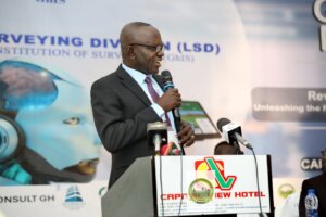
 Honourable Surv. Francis Manu-Adabor, Chairman of the Parliamentary Select Committee on Lands and Natural Resources, has called for a revolutionary approach to land surveying in Ghana through the integration of Artificial Intelligence (AI) and geospatial technologies.
Speaking at the highly anticipated conference of the Land Surveyors Division of the Ghana Institution of Surveyors, Surveyor Manu-Adabor underscored the crucial role of AI in shaping the future of Africa’s land management and development sectors.
The conference, themed “Revolutionizing Land Surveying: Unleashing the Power of Geo-Spatial Artificial Intelligence and Other Modern Techniques,” brought together industry professionals, experts, and stakeholders to explore the latest trends and innovations in land surveying.
The focus was on how AI can drive sustainable development and improve the accuracy and efficiency of land management practices in Ghana.
In his keynote address, Surveyor Manu-Adabor emphasized that AI is not just a technological tool but a transformative force deeply connected to the cultural and environmental contexts in which it is applied.
He stressed the importance of understanding these underlying principles to effectively harness AI for infrastructure development, resource management, and environmental sustainability.
“It is essential to define the foundational techniques behind these advancements,” Manu-Adabor remarked.
“These methods are not just technological innovations but are deeply rooted in the culture and environment where they are applied. This understanding is critical as we develop our infrastructure, manage our resources, and ensure environmental sustainability across the continent.”
Drawing on examples from across Africa, Manu-Adabor highlighted the successes and challenges faced by countries like Kenya in adopting new technologies.
He pointed out that while technological advancements have empowered local communities to overcome significant obstacles, there are still gaps in professional development, particularly in the commercialization of AI.
“The practical knowledge gained in these regions is invaluable,” he continued.
“However, in North Africa, the introduction of media technology revealed gaps in professional development, particularly in the commercialization of AI. The rush to meet commercial demands sometimes led to misinterpretations of goals and outcomes.”
Reflecting on historical technological transformation efforts, Hon. Manu-Adabor recalled initiatives such as a 2019 Soviet Union project to monitor climate change.
Despite various innovative techniques, the challenge of creating accurate models remains a significant hurdle, a challenge that resonates with current experiences in education and professional training.
“Training and education are fundamental to overcoming these challenges,” Hon. Manu-Adabor stated.
 “We need to continue investing in programs that equip our young people with the skills necessary to navigate this rapidly changing technological landscape. The introduction of new technologies in the 1970s, such as television and digital equipment, was a turning point, but it also required a shift in our educational approaches.”
Surv. Manu-Adabor also discussed the rise of blue-spatial technologies, which have revolutionized data collection and analysis in high-resolution development areas.
He noted that these technologies, when combined with AI, are transforming sectors like water management, GIS analysis, 3D modelling, and spatial interoperability.
“India’s rapid advancement in these technologies serves as a model for how we can leverage spatial and AI tools to drive progress in Ghana,” he said.
“The integration of AI with blue-spatial data has proven crucial in enhancing our society’s growth, offering new ways to monitor, collect, and analyze data for better decision-making.”
As Ghana stands on the brink of a profound technological transformation, he emphasized the need for continued adaptation in education and business.
He highlighted the importance of incorporating AI-powered tools and techniques into the curriculum to prepare the next generation for the challenges ahead.
“The cultural experience of integrating AI with blue-spatial data is becoming essential to our business landscape,”
“By leveraging these powerful technologies, we can build more digital capabilities and ensure that Ghana remains at the forefront of innovation in the coming years.”
Hon. Surv. Francis Manu-Adabor’s vision for AI in land surveying, coupled with the collective efforts of the Ghana Institution of Surveyors, marks a significant milestone in Ghana’s journey toward embracing cutting-edge technologies for national development.
President of the Ghana Institution of Surveyors (GhiS), Surv. Dr. Anthony Arko-Adjei, FGhIS, has issued a powerful call to action, urging the nation to embrace and harness the transformative potential of artificial intelligence (AI) in land surveying.
Surv. Dr. Arko-Adjei emphasized the critical importance of integrating advanced machine intelligence into the surveying profession to drive innovation and ensure sustainable development.
“We stand on the brink of a new era where advanced machine intelligence is no longer a distant dream but a present reality,”
“The integration of AI into land surveying holds the promise of revolutionizing our profession, enabling us to quantify and analyze data with unprecedented precision and efficiency.”
Surv. Dr. Arko-Adjei highlighted the pressing need to address the challenges associated with AI’s integration into land surveying, including the creation of third-party indexes, the responsible reuse of data, and the development of on-demand resources.
He underscored that while the potential of AI is vast, it must be embraced with caution and responsibility.
“Let us not be blinded by the allure of AI’s capabilities,” he cautioned. “As we unlock the potential of AI in land surveying, we must remain vigilant in addressing the ethical and environmental implications of this transformation. Our focus should be on using AI to not only improve our practices but also to contribute meaningfully to the broader goals of combating climate change, reducing pollution, and enhancing transparency in our work.”
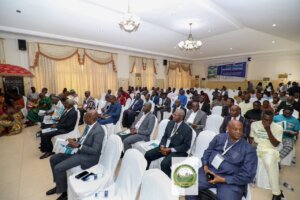
Surv. Dr. Arko-Adjei’s speech was met with resounding approval from the audience, which included leading experts in AI and land management, government officials, and industry stakeholders.
He encouraged all participants to engage actively in the ongoing discussions about the future of AI in surveying, emphasizing that collaboration and commitment to excellence and integrity would be crucial in shaping a better future for the nation.
“Our institution is dedicated to fostering innovation for the betterment of our country, not merely casting shadows,” he declared.
“This conference is a testament to our commitment to exploring meaningful solutions and providing a platform for critical discussions that will drive progress.”
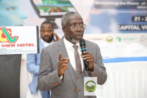
Taking his turn, Surv. Robert Hackman Antwi, FGhIS, entreated all participants to partake fully in all the activities as it presents an opportunity to learn, network, and be inspired.
He lauded the Conference Planning Committee for working tirelessly to put together a successful conference.
Surv.Isaac Larbie, FGhIS, Chairman of the Land Surveying Division, in his 2024 Conference address, noted that land surveying has been applied in many engineering fields for the determination, prediction, and modeling challenges.
He threw light on how the profession has evolved over the years and called on all to embrace the new trend of application which has been developed to apply data-driven techniques to solve the challenges of land surveying which is Artificial Intelligence.
On his part, the Director at the Eastern Regional Coordinating Council, John Donkor who stood in for the Eastern Regional Minister, emphasized the transformative impact of artificial intelligence (AI) in agriculture, particularly in promoting environmental efficiency and managing vital resources.
He highlighted the significant role AI plays in enhancing the standard of living and building a sustainable future.
“These innovations are not just tools; they are catalysts for promotion, development, management, and analysis,” Donkor stated.
“AI is at the forefront of this transformation, enabling us to gain a deeper understanding of our world and make remarkable achievements in addressing critical issues such as land management, air pollution, and climate change.”
Mr. Donkor explained that by integrating AI with traditional content, new possibilities emerge, such as identifying areas of the Earth that are less affected by gravity.
This, he noted, leads to more efficient resource management and contributes to a more sustainable Earth.
“AI’s application in agriculture and other sectors is crucial for improving environmental efficiency,” he continued.
“However, we must also recognize the challenges that come with these technologies, particularly in regions like India, where the full benefits have not yet been realized.”
Mr. Donkor concluded by expressing his enthusiasm for the forum and the collaborative efforts to harness AI’s potential for a better future, emphasizing the need to continue learning and adapting to these technological advancements.
Oma

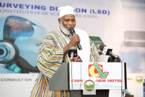
nhene of New Juaben Traditional Area, Nana Kwaku Boateng all lauded GhiS for the great initiative.
He was optimistic that a revolutionary approach to land surveying in Ghana through the integration of Artificial Intelligence (AI) and geospatial technologies will help shape the future of land management in Africa.
“I want to call on all to embrace the spirit of innovation as we embark on this transformative journey towards revolutionary land surveying practices.”
The conference, expected to attract over five hundred participants, including land surveyors, government officials, academics, and industry stakeholders, is poised to be a landmark event in the evolution of land surveying in Ghana.
By fostering innovation, excellence, and collaboration, the Land Surveying Division is committed to contributing to Ghana’s sustainable development goals, ensuring that the nation continues to thrive in a rapidly changing world.
The event, which has set the stage for future advancements in the use of AI in land surveying, marks a significant milestone in Ghana’s journey toward embracing cutting-edge technologies for national development.
The conference, which features a series of presentations, workshops, and discussions led by industry experts, has set the stage for the future of land surveying in Ghana.
Some of the insightful presentations made included; the AI approach for predicting local crustal movement using Continuous Operating Reference System (CORS) stations and the reaffirmation of the Ghana-Togo Maritime Boundary which was handled by Surv. Alexander Ayettey, Head of Photogrammetry at the Lands Commission.
The three-day conference, which went underway at Capital View, Koforidua is a testament to the Land Surveying Division’s commitment to changing the narrative in their profession.
END
COMMS UPDATES

